Course Maps
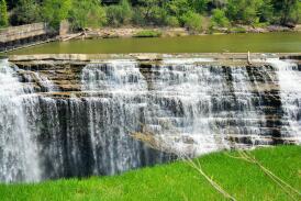
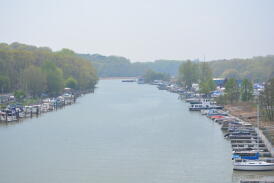
If you're looking for a breathtaking course that takes you alongside a gorgeous river, complete with 3 waterfalls, includes views of Lake Ontario, and winds itself through a heck of a lot of history that created our great city, this course is for you! Just for fun, we've also thrown in 4 bridges, 2 scenic parks, and a couple of hills to provide the perfect mix of elevation change to challenge you along the way. Scroll down to view course maps and information.
Prepare yourself for overwhelming support from spectators and volunteers along the course - especially from the neighborhoods along St. Paul and the high school athletes powering you up Brewer Street Hill. Not to mention, the pure excitement of the crowds along Morrie Silver Way as you make your way to the finish line outside ESL Ballpark.
Time Cutoff
You must maintain a 16 min/mile in order to finish within the 11AM time cutoff. Here is a pace chart to help determine where you are at by pace. Volunteers and on course support support will cease at the following time cuts based on the 16 minute mile. At this time road re-openings will occur as well. The finish line will close promptly at 11AM. There is a 3.5 hour course limit for the half marathon. The finish line will close at 11am.
We will be having a SAG shuttle for those that fall off pace to shuttle them back to the finish.
YOU MUST MAKE IT PAST THE 15K MARK BY 9:54AM. IF YOU DO NOT MAKE IT PAST THE 15K MARK BY 9:54AM THERE WILL BE A SHUTTLE AT THE CORNELL CO-OP (WATER STOP 4 AREA) TO PICK YOU UP AND BRING YOU BACK TO THE FINISH. THIS IS A NO QUESTIONS ASKED SITUATION. PLEASE LISTEN TO RACE PERSONNEL SHOULD THIS HAPPEN. Please note the shuttle will wait for all athletes in this scenario to take them back so it's one single shuttle. Unfortunately you will not get a medal should this occur. Race personnel will take down your bib number. Thank you for obliging to this.
.
COURSE MAPS ON MAP MY RUN:
*ALERT* - We are back to the original course where we will go over the Pont De Rennes Bridge after the Genesee Brewery and head to the finish line.
- Click Here to see the 5K Course
- See course adjustment above
- Click Here to see the Half Marathon Course
- See course adjustment above and certified course info below
- Click Here to see the Kids 1/2 Mile Course
USATF CERTIFIED MAPS:
![]()
ELEVATION CHARTS:
COURSE DESCRIPTION - ROCHESTER HALF MARATHON:
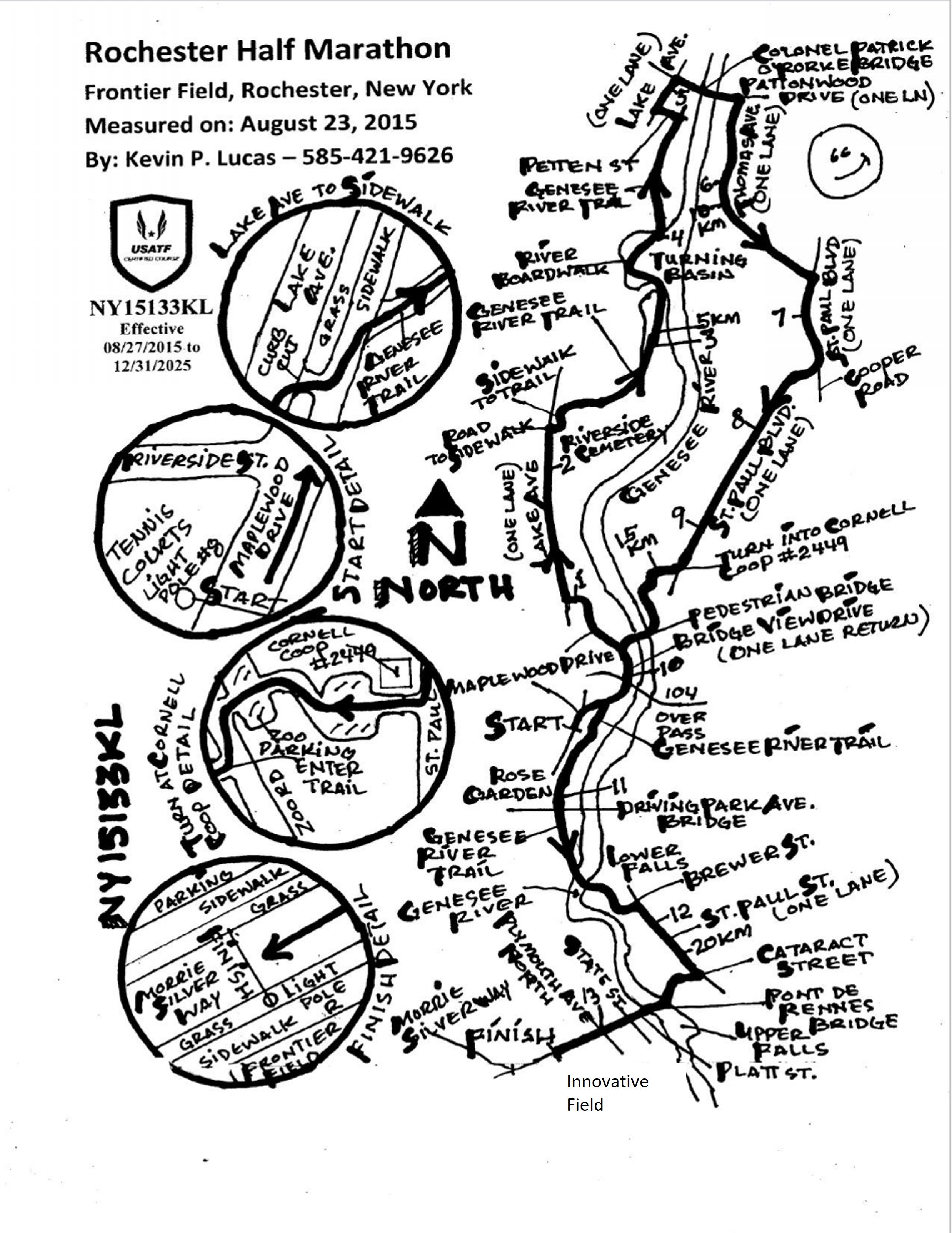
The race start is in Maplewood Park on Maplewood Drive at 7:30AM
The shuttle bus service is included in your race registration. It is for race participants only.
- Runners will line up at the Starting Line, located on Maplewood Drive (by the tennis courts)
- You will head northeast on Maplewood Drive toward Riverside Street and continue down Maplewood, veering to the right on Bridgeview Drive
- From Bridgeview Drive, you will continue to Maplewood Drive, staying on Maplewood Drive until you get to Lake Avenue, taking a right onto Lake Avenue
- Heading North on Lake Avenue, you will pass the historic Riverside Cemetery and get on the Genesee Riverway Trail (take a right off Lake Avenue to the river trail)
- You will pass through gorgeous Turning Point Park, staying on the river trail until Petten Street
- Take a left onto Petten Street, and a right onto Lake Avenue, heading north on Lake Avenue
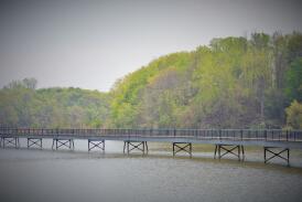
- You will take a right off Lake Avenue and cross over picturesque O’Rorke Bridge where you can view the Port at Charlotte & Lake Ontario on the left and the Genesee River on the right
- After the bridge, you will take a right onto Thomas (the relay stop exchange will be here)
- You will head south on Thomas to St. Paul
- You will take a right onto St. Paul and continue heading south
- From St. Paul, you will take a right at Cornell Cooperative Extension into their parking lot, continuing to the back of the lot which leads you to the Seneca Park
Zoo's overflow parking lot - Cross the zoo parking lot, and take a left to get on the river trail to the pedestrian bridge in Seneca Park
- You will cross over the pedestrian bridge heading back to Maplewood Park
- Once you are over the bridge and come out to Bridgeview Dr, take a left on Bridgeview and go under the 104 bridge, taking a left after the bridge onto the river trail & head southwest toward Driving Park (where the Maplewood Rose Garden is)
- At this point, the Half Marathon will continue south.
- Stay on the river trail crossing over the river again at Middle Falls, then going left after the bridge and turning right onto Brewer Street
- Half marathoners will take Brewer Street to St. Paul, taking a right on St. Paul, passing the Brewery and turning right onto Cataract Street to go over the Pont de Rennes Bridge
- crossing over State Street & Plymouth Avenue to the Finish Line in front of ESL Ballpark on Morrie Silver Drive
HALF MARATHON COURSE TIME LIMIT:
You must maintain a 16 min/mile in order to finish within the 11AM time cutoff. Here is a pace chart to help determine where you are at by pace. Volunteers and on course support support will cease at the following time cuts based on the 16 minute mile. At this time road re-openings will occur as well. The finish line will close promptly at 11AM. There is a 3.5 hour course limit for the half marathon. The finish line will close at 11am.
We will be having a SAG shuttle for those that fall off pace to shuttle them back to the finish.
YOU MUST MAKE IT PAST THE 15K MARK BY 9:54AM. IF YOU DO NOT MAKE IT PAST THE 15K MARK BY 9:54AM THERE WILL BE A SHUTTLE AT THE CORNELL CO-OP (WATER STOP 4 AREA) TO PICK YOU UP AND BRING YOU BACK TO THE FINISH. THIS IS A NO QUESTIONS ASKED SITUATION. PLEASE LISTEN TO RACE PERSONNEL SHOULD THIS HAPPEN. Please note the shuttle will wait for all athletes in this scenario to take them back so it's one single shuttle. Unfortunately you will not get a medal should this occur. Race personnel will take down your bib number. Thank you for obliging to this.
COURSE DESCRIPTION - ROCHESTER 5K:
The race start is in Maplewood Park on Maplewood Drive at 7:40AM
The shuttle bus service is included in your race registration. It is for race participants only.
- Runners will line up at the Starting Line, located on Maplewood Drive (by the tennis courts)
- You will head northeast on Maplewood Drive toward Riverside Street and continue down Maplewood, veering to the right on Bridgeview Drive
- From Bridgeview Drive, you will continue to Maplewood Drive, staying on Maplewood Drive until you turn around back onto the Genesee River Path to head south towards Maplewood Garden
- At this point, the 5K will continue south.
- Stay on the river trail crossing over the river again at Middle Falls, then going left after the bridge and turning right onto Brewer Street
- 5Kers will take Brewer Street to St. Paul, taking a right on St. Paul, passing the Brewery and turning right onto Cataract Street going over the Pont de Rennes Bridge
- crossing over State Street & Plymouth Avenue to the Finish Line in front of ESL Ballpark on Morrie Silver Drive
WATER STOPS/PORTA-POTTIES:
All water stops will have water and porta-potties. There will be 5 water stops each with water and electrolyte drink.
- Water Stop 1 - at 2ish Miles outside Riverside Cemetery sponsored by Cancer Support Community at Gilda's Club
- Water Stop 2 - at 4.5ish Miles at end of Genesee River Path before you turn up Petten sponsored by Black Girls Do Bike
- Water Stop 3 - at 6.5ish miles on Thomas Ave and Fairview Rd sponsored by lululemon (Clover View Plaza Store)
- Water Stop 4 - at 9ish miles at Cooperative Extension Building on St Paul sponsored by Saint Ambrose Academy
- Water Stop 5 - 11.5ish miles at Brewer Street by RGE hosted by Harley Allendale Columbia XC Team